I would like to use crdesigner to convert my osm file to osm file including lanelets. Therefore I import the osm file (where I set the attributes in JOSM) and convert it to common road. This file will be saved as xml and reloaded in crdesigner to convert it to lanelet/lanelet2 file.
After the conversion I load the initial file and the new file in JOSM to compare it. When I place a part of my track exactly fitting to the original file I have a missmatch on some other position (see pictures below).
I also tried out to set in the crdesigner the earth radius to the one for WGS84 ellipsoid but this does not solve the isse. Maybe I need to change some ot the other settings for OSM files or is crdesigner using a different ellipsoid or a spherical model for the calculation which leads to the missmatch?
I have a own created OSM file from a virtual created test environment. There I have 4 lanes with 5m width. In the OSM file I have only the points and way of the middle of the road.
This file I’ll load to JOSM and add the attributes for the road (roadtyp, number of lanes etc.)
Afterwards load the file to crdesigner and convert to crdesigner file and export it to lanelet.
The new lanelet file will be loaded in JOSM to check. In JOSM I need to slightly move the lanelets, background is that when I load the osm file in crdesigner the file will be centered in the window and I loose somehow the relation to the initial GPS coordinates. But when I do so and fit one point I see the missmatch in the other parts of the map.
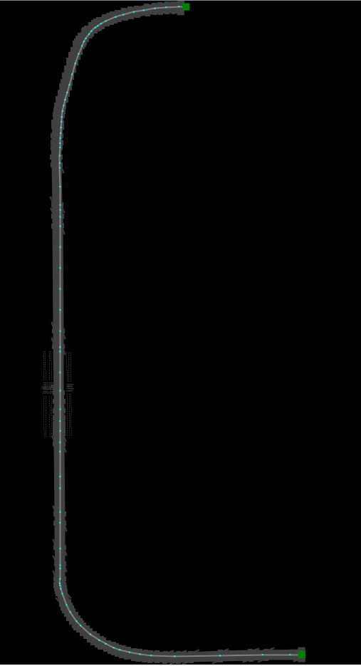
In the picture you can see in grey the loaded lanelet file from crdesigner, the grey line with the blue dots (waypoints) is the initialy used osm file which should represent the middle of the road in that case. But I see there the missmatch.
Conversion was now done with default setting of crdesigner only GPS coordinates were setten for the export.
This sounds like a reasonable rootcause. Thanks!
Is there a possibility to change that in the setting or to change in the settings something that the spline is comming closer to the initial path/waypoints?