Hi,
I met some problem when converting OSM to commonRoad and then to lanelet.
first, I downloaded data from OSM with download_around_map(‘test.osm’,48.75793, 11.43109)
next, osm_to_commonroad().
then, modify location.gpsLatitude/gpsLongitude from 999 into 48.75793, 11.43109 in .xml file
at last, commonroad_to_lanelet() with default proj string.
I have 2 questions,
- is there a way to set location.gpsLatitude/Longitude with code instead of typing manually?
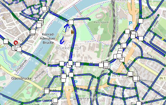
- why would this offset happen?

I visualized the converted lanelet file in JOSM, but the roads cannot match with the base map (Imagery->OSM carto(standard))
I tried to change projection string into WGS 84 / Pseudo-Mercator - Spherical Mercator, Google Maps, OpenStreetMap, Bing, ArcGIS, ESRI - EPSG:3857 this one, but the scale of converted lanelet was not correct (offset was even worse than using default proj string). I have no idea how should I set the proj string for cr2lanelet…